 Tweet
Tweet
http://www.fs.usda.gov/Internet/FSE_...rdb5202572.pdf
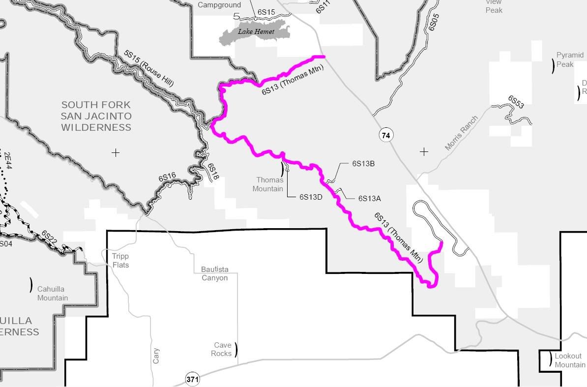
6S13 Thomas Mountain
Length: 14.5 miles
Trail rating: Green Circle Easiest. Street legal vehicles ONLY
Elevation: 4400' to 6800'
North entrance on Hwy 74 at N33� 39.462 W116�39.918
South entrance on Hop Patch Springs Rd at N33� 35.500 W116� 37.144
Lat/Lon format is hddd� mm.mmm and WGS84 datum
It is always a good idea to call the ranger station before heading in to the forest and get a current conditions report. Idyllwild Ranger Station (909) 382-2921
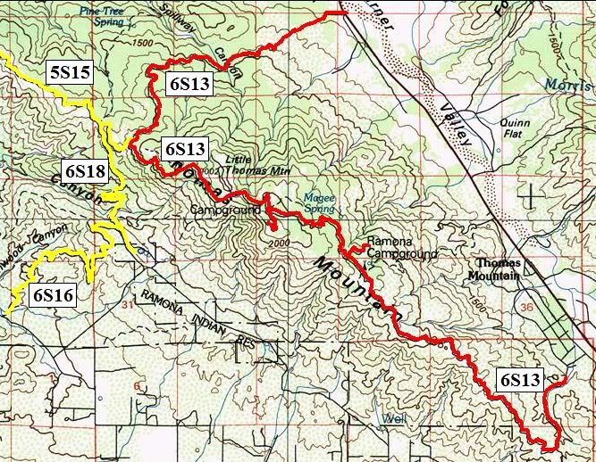


Comment