 Tweet
Tweet
http://www.fs.usda.gov/Internet/FSE_...rdb5202570.pdf
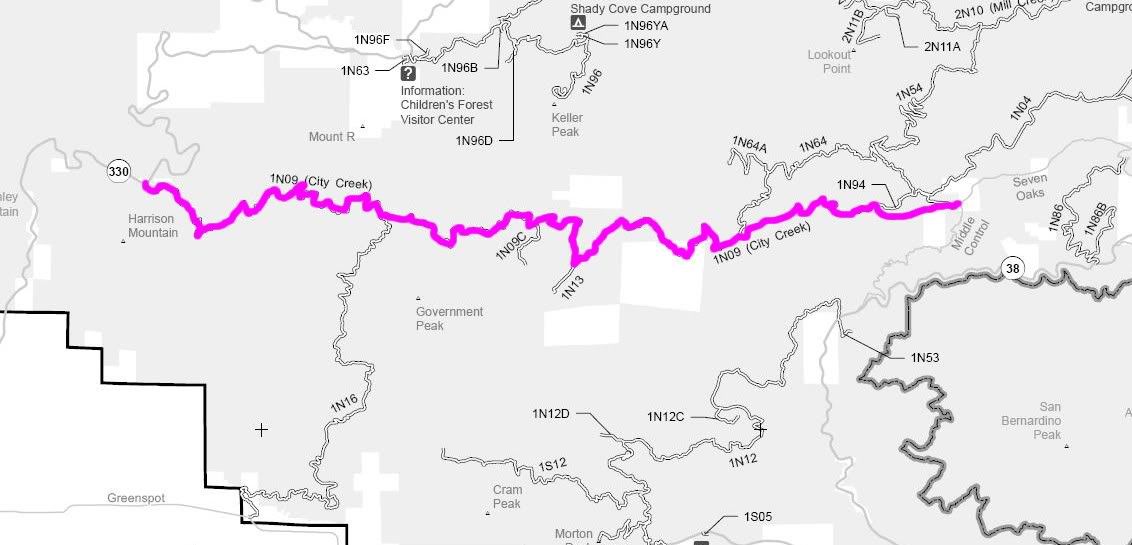
1N09 City Creek
Length: 22 miles
Trail Rating: Green Circle Easiest
Street legal vehicles ONLY
Elevation: 3000’ to 4800’
West entrance on Hwy 330 at
N34� 10.614 W117� 09.238
Middle entrance on 1N16 at
N34� 10.184 W117� 05.713
East entrance on Seven Oaks Rd at
N33� 10.371 W116� 57.009
Lat/Lon format is hddd� mm.mmm
WGS84 datum
[COLOR="Red"]1N09 City Creek is CLOSED in high fire conditions[/COLOR]
It is always a good idea to call the ranger station before heading in to the forest and get a current conditions report.
Arrowhead Ranger Station (909) 382-2782
Mill Creek Ranger Station (909) 382-2882
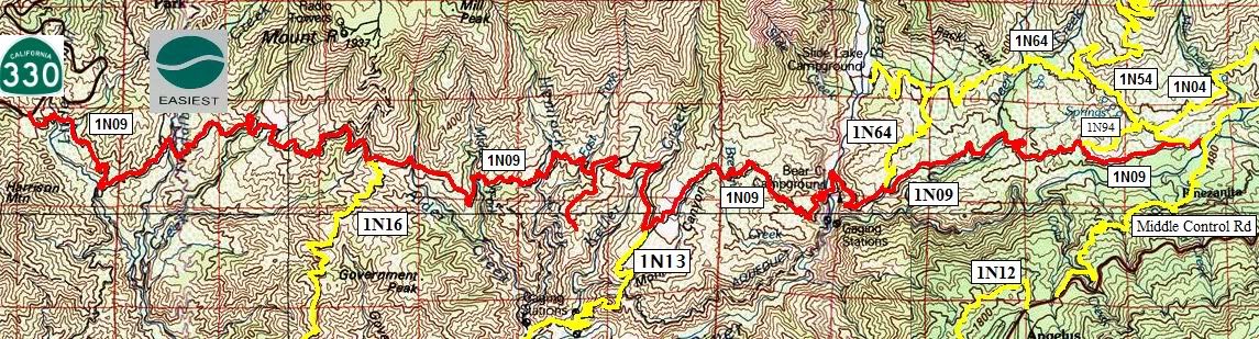