 Tweet
Tweet
http://www.fs.usda.gov/Internet/FSE_...rdb5202570.pdf
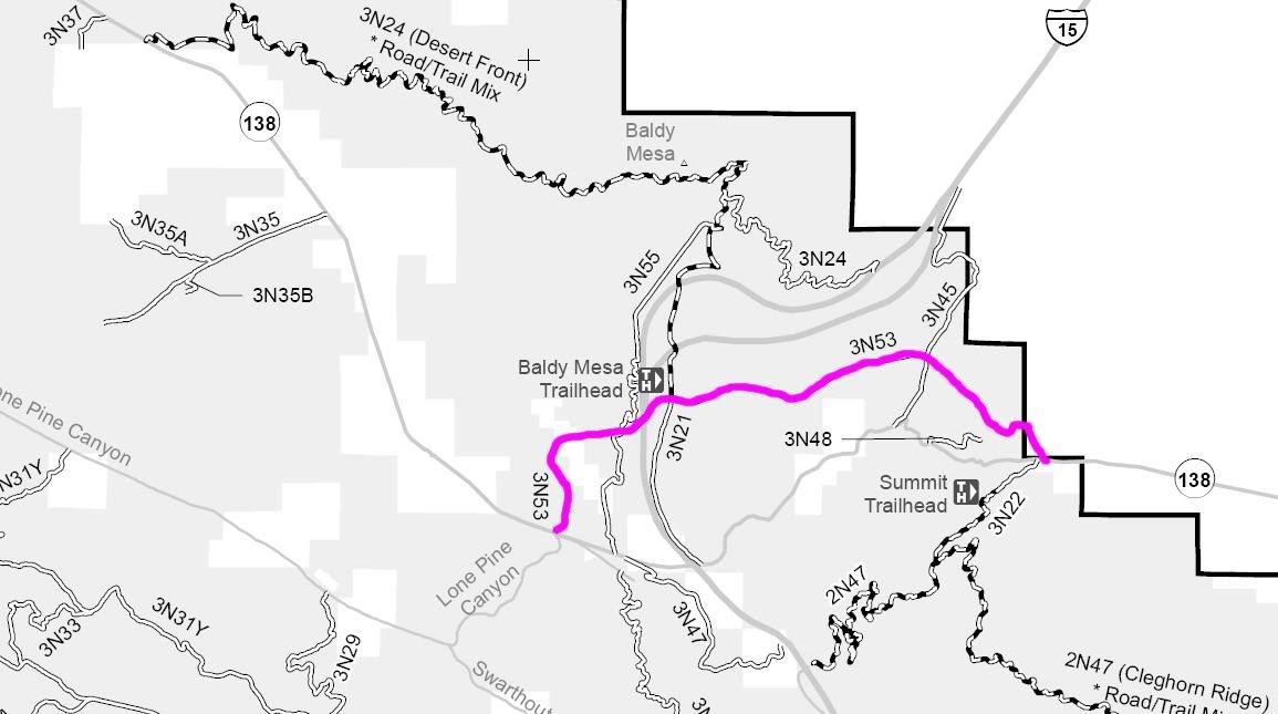
3N53
Length: 6 miles
Trail Rating: Green Circle Easiest
Street Legal Vehicles ONLY
Elevation: 3300’ to 3700’
West entrance on Hwy 138 at
N34� 18.955 W117� 29.740
Middle entrance on 3N45 at
N34� 20.283 W117� 26.374
Middle entrance on 3N21 at
N34� 19.970 W117� 28.700
Middle entrance on 3N55 at
N34� 19.715 W117� 29.141
East entrance on Hwy 138 at
N34� 19.502 W117� 25.276
Lat/Lon format is hddd� mm.mmm WGS84 datum
It is always a good idea to call the ranger station before heading in to the forest and get a current conditions report. Lytle Creek Ranger Station (909) 382-2851
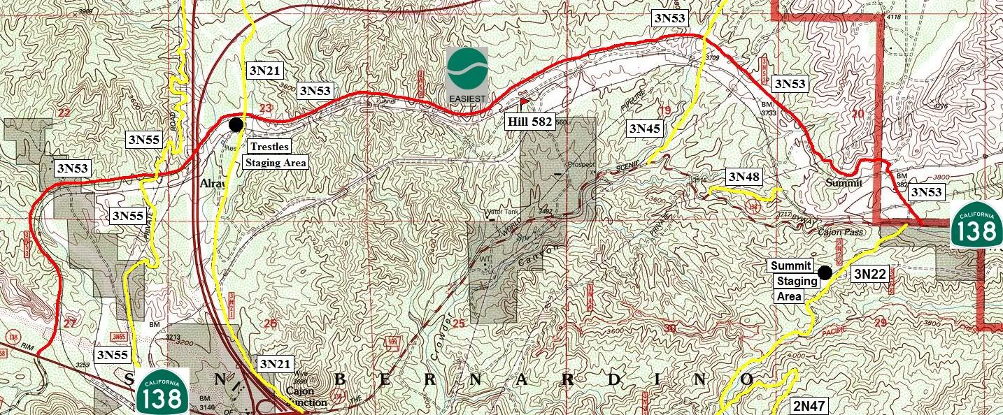