 Tweet
Tweet
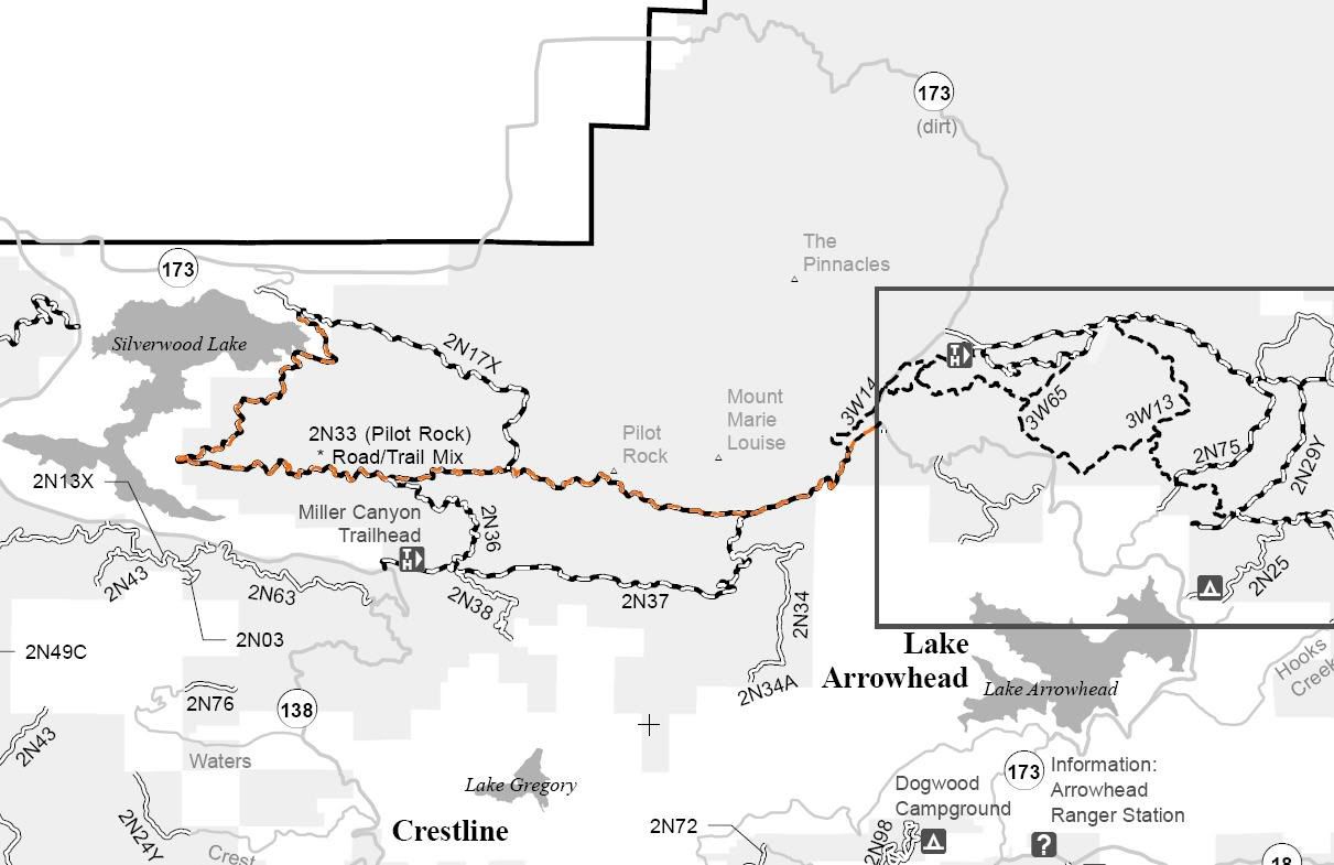
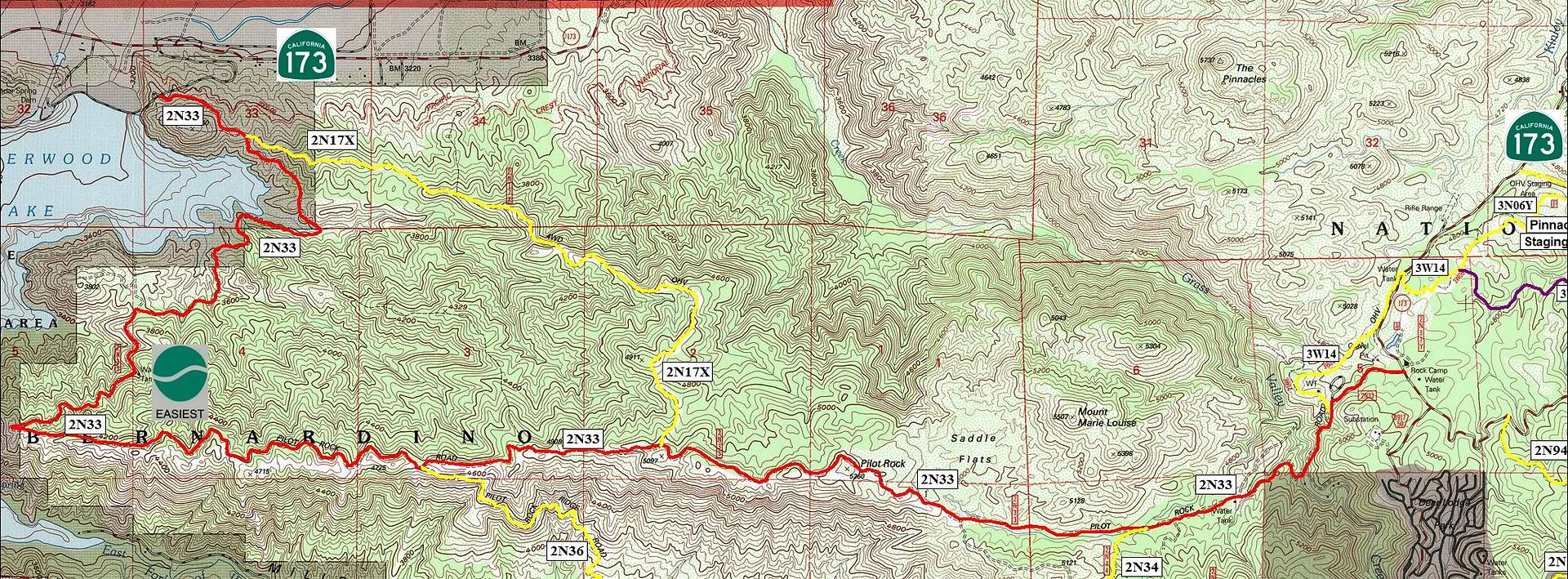
2N33 Pilot Rock
Length: 11 miles
Trail Rating: Green Circle Easiest - Street legal vehicles and green sticker vehicles allowed
Elevation: 3400’ to 5250’
Trail adopted by: Lost Jeeps So Cal
West entrance on Cedar Springs Dam Rd at N34� 18.303 W117� 18.597
Middle entrance on 2N36 at N34� 16.868 W117� 17.388
Middle entrance on 2N17X at N34� 16.953 W117� 16.284
Middle entrance on 2N36 at N34� 16.637 W117� 14.035
Middle entrance for 50" vehicles on 3W14 at N34� 17.081 W117� 13.178
East entrance on Hwy 173 at N34� 17.239 W117� 12.846
Lat/Lon format is hddd� mm.mmm WGS84 datum
It is always a good idea to call the ranger station before heading in to the forest and get a current conditions report. Arrowhead Ranger Station (909) 382-2782
SBNF Motor Vehicle Use Map (MVUM)
SBNF Google Earth file