 Tweet
Tweet
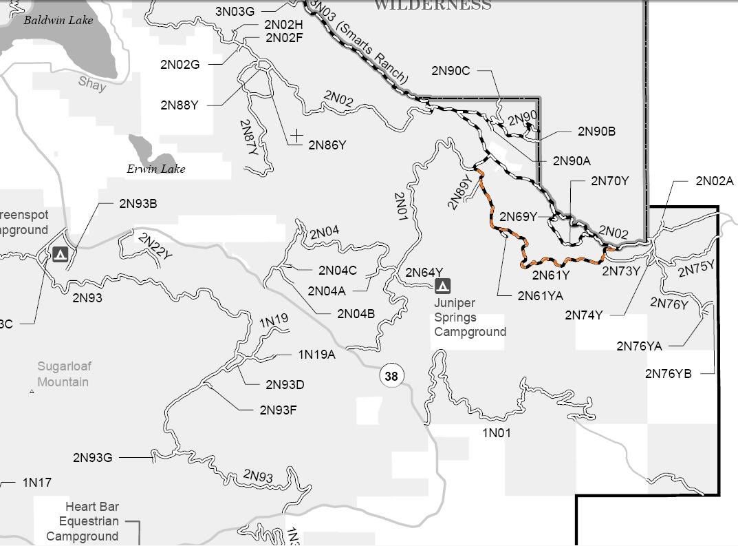
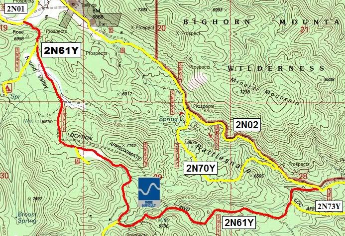
2N61Y Round Valley
Length: 3.5 miles
Trail Rating: Blue Square More Difficult - Street legal vehicles and green sticker vehicles allowed
Elevation: 6800� to 7000�
Adopted by: Riverside 4 Wheelers
East entrance on 2N01 at N34� 14.622 W116� 42.410
Middle spur* exit on 2N89Y at N34� 14.474 W116� 42.321
Middle spur* exit on 2N61YA at N34� 13.886 W116� 42.037
Middle spur* exit on Heartbreak Ridge/Pontiac Sluice at N34� 13.450 W116� 41.731
Middle entrance on 2N73Y at N34� 13.565 W116� 40.509
West entrance on 2N02 at N34� 13.641 W116� 40.301
Lat/Lon format is hddd� mm.mmm WGS84 datum
It is always a good idea to call the ranger station before heading in to the forest and get a current conditions report. Big Bear Ranger Station & Discovery Center (909) 382-2790
SBNF Motor Vehicle Use Map (MVUM)
SBNF Google Earth file
*a spur is a dead end trail