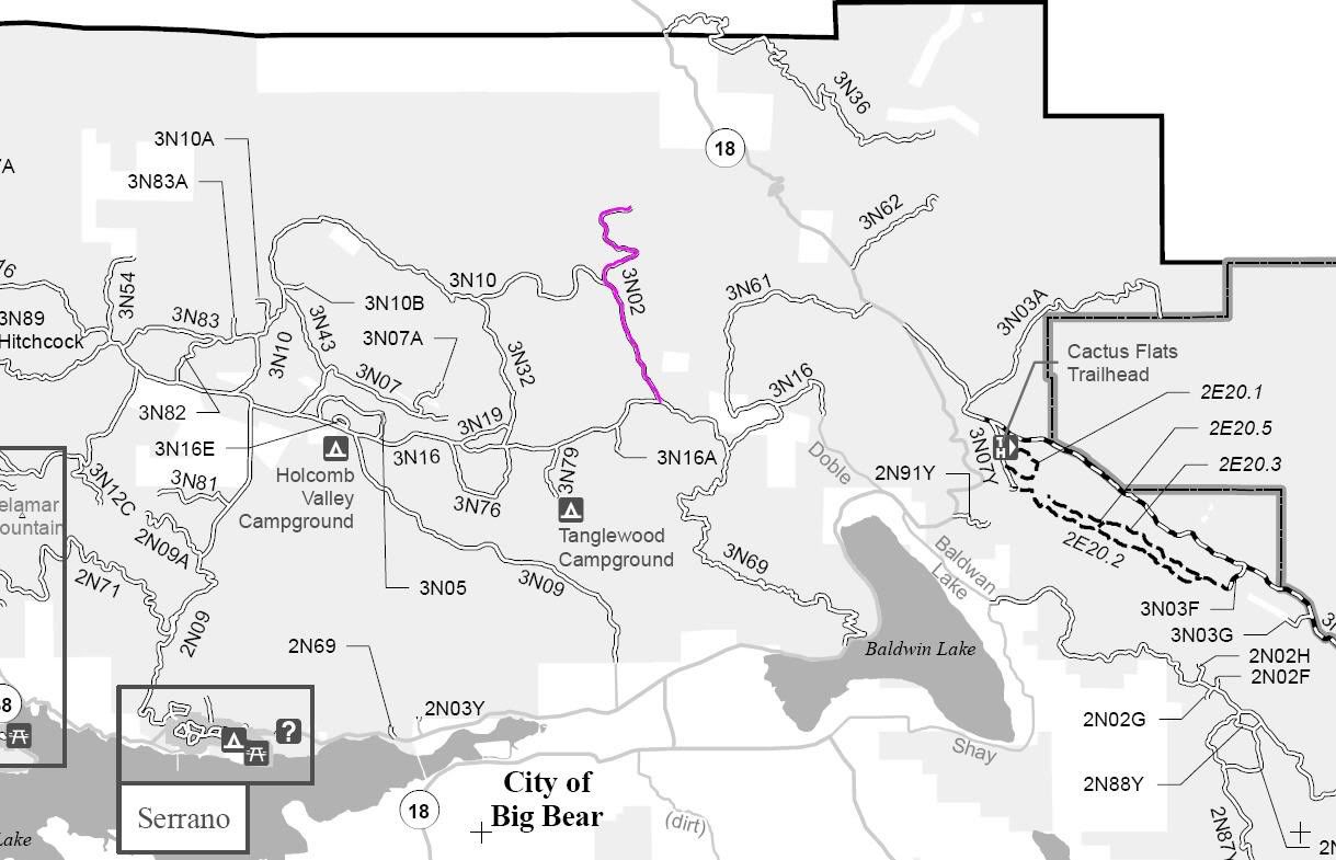
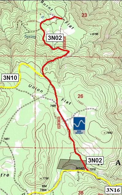
Announcement

Collapse
No announcement yet.

3N02 Burnt Flat

Collapse

Forum Thread First Post

Collapse
X
 
  • Filter
  • Time
  • Show
Clear All
new posts

  • 3N02 Burnt Flat


    3N02 Burnt Flat

    Trail length: 2.5 miles

    Trail Rating: Blue Square More Difficult - Street legal vehicles ONLY

    Elevation: 6800' - 7500'

    Trail adopted by: So Cal Broncos

    South entrance on 3N16 at N34° 18.305 W116° 50.846

    Middle entrance on 3N10 at N34° 19.212 W116° 51.351

    Lat/Lon format is hddd° mm.mmm WGS84 datum

    It is always a good idea to call the ranger station before heading in to the forest and get a current conditions report. Big Bear Ranger Station & Discovery Center (909) 382-2790

    SBNF Motor Vehicle Use Map (MVUM)

    SBNF Google Earth file
    Attached Files
    Last edited by FishPOET; 02-22-11, 11:09 AM.
    Over 2500 hours donated to the San Bernardino National Forest. Life member of CA4WD, CORVA & BRC. Tread Lightly Trainer. Reforestation Supervisor. CASSP

  • #2
    That is a very neat area. I don't know if it's still there but there was an apple tree and a small pond. I'm surprised it's rated blue. It used to pretty tough getting in and out of there.

    Thanks Doug for poating.
    SBCO Fire Dept. CERT volunteer
    MJR moderator
    MJR Adopt-a-Trail Crew member
    Jeep Patrol Leader
    Reforestation Supervisor
    Licensed Ham - n6ujm
    Eagle Scout

    Comment

    Working...
    X