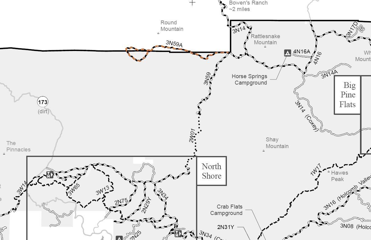
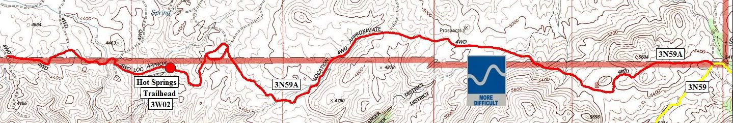
Announcement

Collapse
No announcement yet.

3N59A Luna Mountain

Collapse

Forum Thread First Post

Collapse
X
 
  • Filter
  • Time
  • Show
Clear All
new posts

  • 3N59A Luna Mountain


    3N59A Luna Mountain

    Length: 6 miles

    Trail Rating: Blue Square More Difficult - Street legal vehicles and green sticker vehicles allowed

    Trail adopted by: So Cal FJ Cruisers

    Elevation: 4200' to 5400'

    East entrance on 3N59 at N34° 21.161 W117° 06.304

    Lat/Lon format is hddd° mm.mmm WGS84 datum

    It is always a good idea to call the ranger station before heading in to the forest and get a current conditions report. Arrowhead Ranger Station (909) 382-2782

    SBNF Motor Vehicle Use Map (MVUM)

    SBNF Google Earth file
    Attached Files
    Over 2500 hours donated to the San Bernardino National Forest. Life member of CA4WD, CORVA & BRC. Tread Lightly Trainer. Reforestation Supervisor. CASSP

  • #2
    Yea doug thanks alot for doing this as Mitch said. It's so nice to copy all the maps you have put up.
    IN A LAND OF FREEDOM WE ARE HELD HOSTAGE BY THE TYRANNY OF POLITICAL CORRECTNESS!!

    Better To Burn Out Than To Rust Out!

    Comment

    Working...
    X