Announcement

Collapse
No announcement yet.

The Arizona Strip

Collapse

Forum Thread First Post

Collapse
X
 
  • Filter
  • Time
  • Show
Clear All
new posts

  • Trail Report: The Arizona Strip

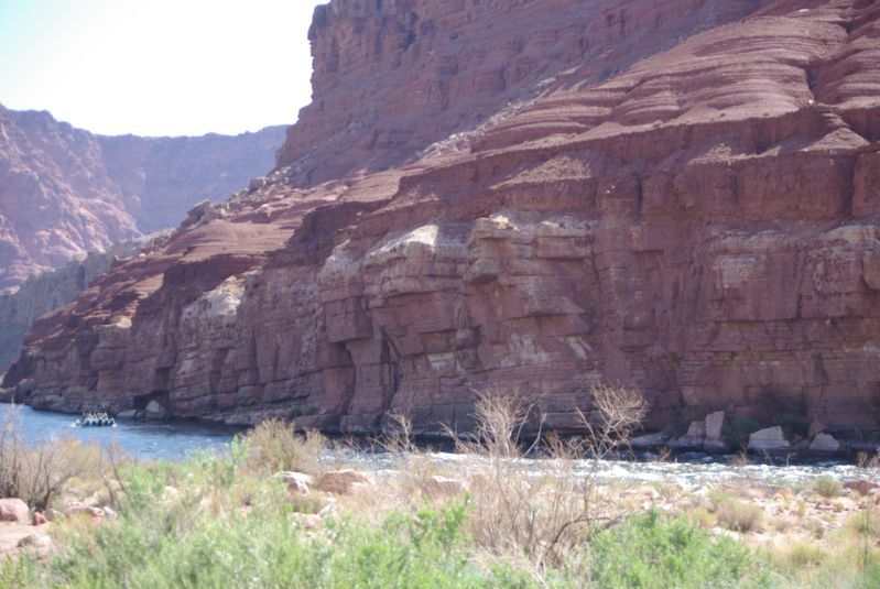
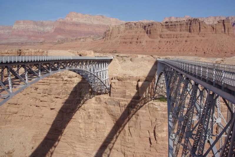
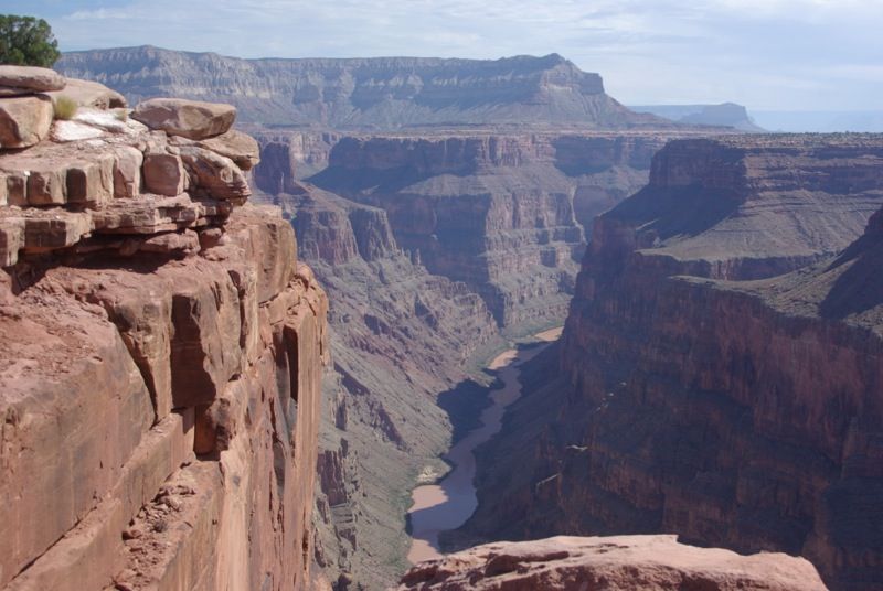
    The Arizona Strip is the portion of the State of Arizona that lies between the Colorado River and the Utah border. Because of the physical barrier created by the Grand Canyon, Marble Canyon and the Colorado River, this portion of the state is geographically isolated from the rest of Arizona. Only two highways cross the Colorado River and connect the Arizona Strip to the rest of the state—US 89 at Page, AZ and US 89A at Navajo Bridge, AZ.

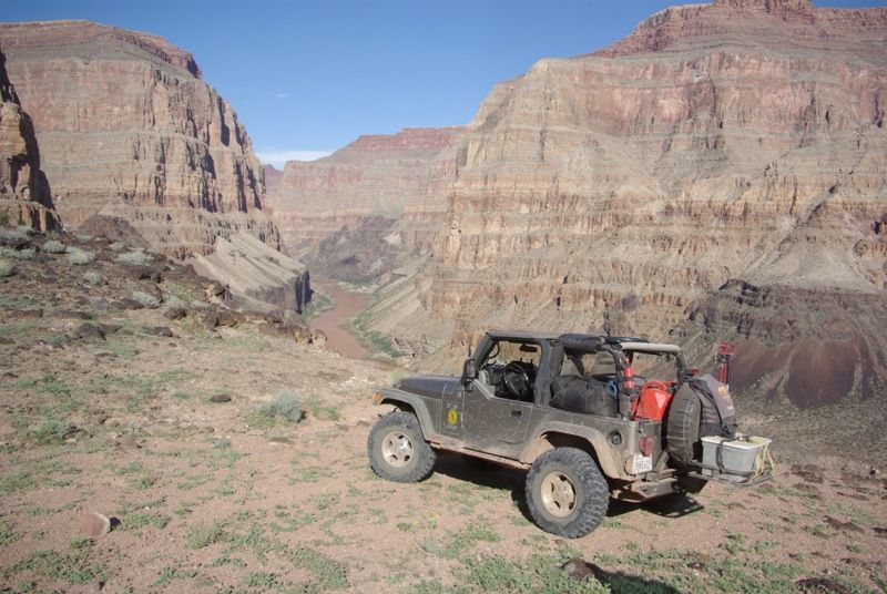
    I recently explored the Arizona Strip with some friends from Arizona and Nevada. Our plan for this run was to start at Lake Powell and follow the north bank of the Colorado River down to Lake Mead, visiting as many overlook points as we could reach in a Jeep. On the river, the run from Lake Powell to Lake Mead is about 300 river miles, but in a Jeep this would take about 700 miles, most of which would be on dirt. I met one of my friends in Kanab, UT. Two other Jeeps would join us later on the run.

    Monday, August 27, 2012. Kanab, UT to Lake Powell, AZ

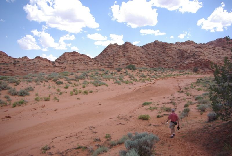
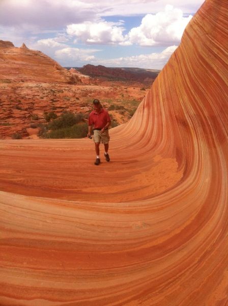
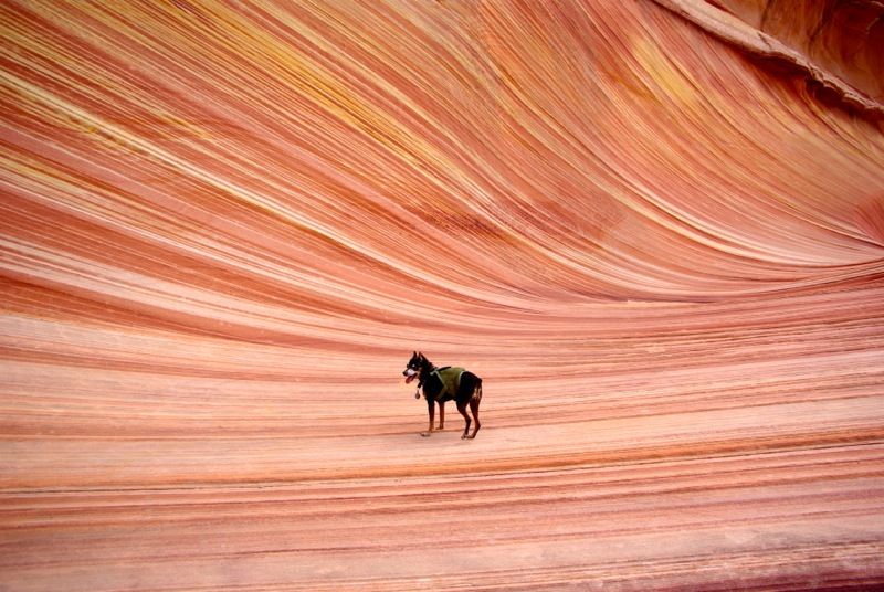
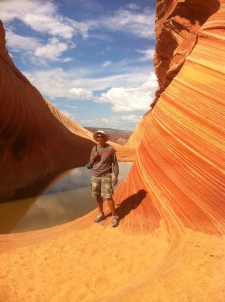
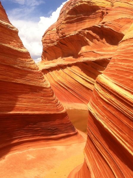
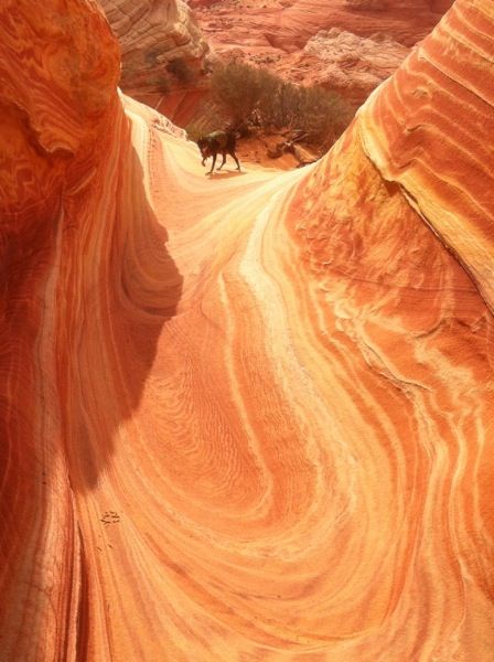
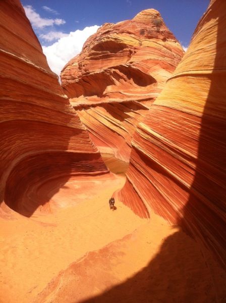
    Our first stop was at the BLM Office in Kanab, UT, where we entered the daily lottery for permits to the Wave in Coyote Butte. The Wave is a unique geologic feature located near the Utah-Arizona border about midway between Kanab, UT and Page, AZ. The BLM only allows 20 visitors per day to the site; 10 slots are awarded by an advance lottery, and the remaining 10 slots are awarded in a daily lottery for visits on the next day. Normally, there are 40 or 50 people vying for the 10 daily slots, but on the day that we entered the lottery, there were only 33 people competing for the 10 slots. If we won a permit, we would hike to the Wave; if we did not win a permit, there were plenty of Jeep trails in the Kanab area to explore. We were lucky; we won one of the permits to visit the Wave the next day. After receiving the permit, some maps, and some hiking tips from the BLM Ranger, we spent the rest of the day exploring the area around Kanab then we headed to Lake Powell to camp for the night.

    We went to the Hog Canyon OHV area along the ridge above Kanab. There are numerous Jeep, ATV and motorcycle trails in the area. We ran three of the easy/moderate trails. This was the start of our trip, and we didn’t want to risk breakage, so we avoided the black diamond trails:


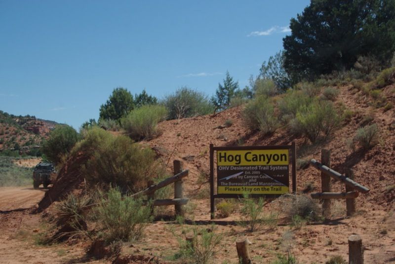
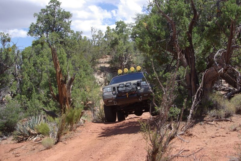
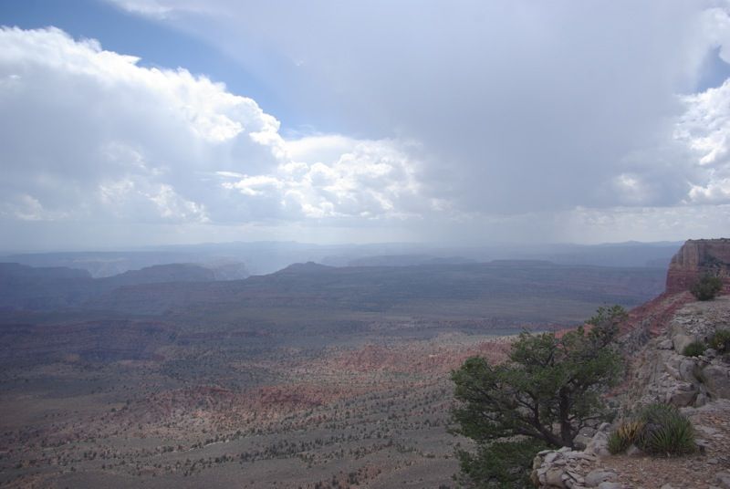
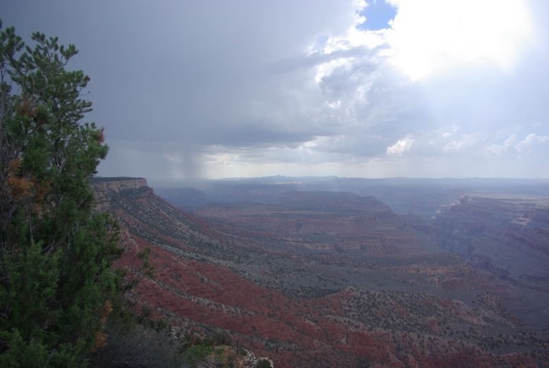
    While wheeling in the Hog Canyon area, clouds built up, and we could see lightning and rain showers and hear the thunder, but the storm missed us. This turned out to be the typical weather pattern for the rest of the trip; sometimes, the rain showers would miss us, sometimes the rain showers would drench us.

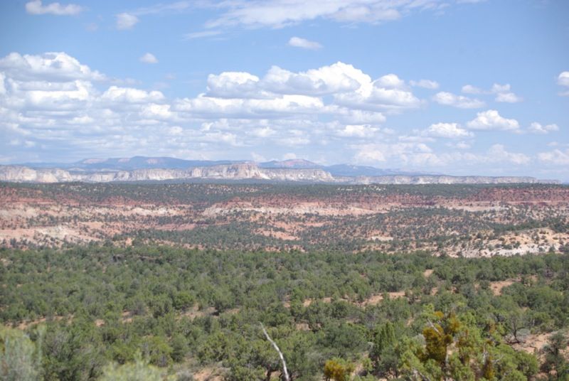
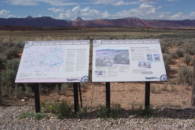
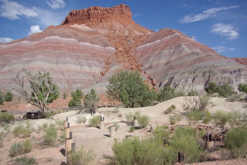
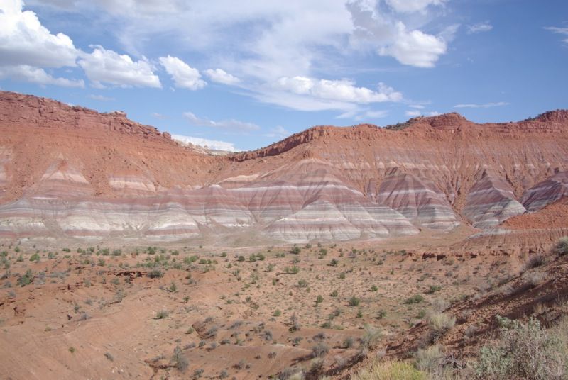
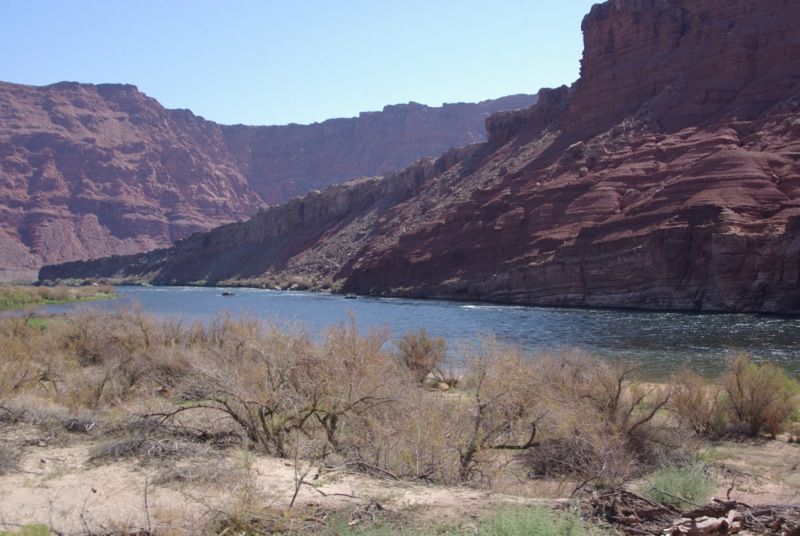
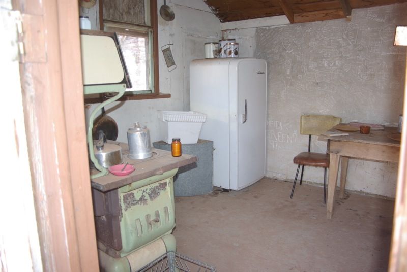
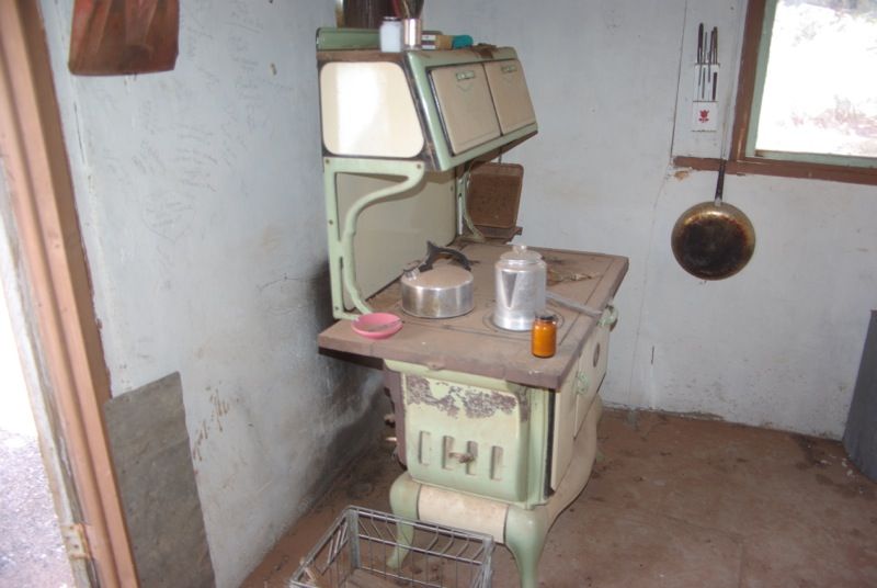
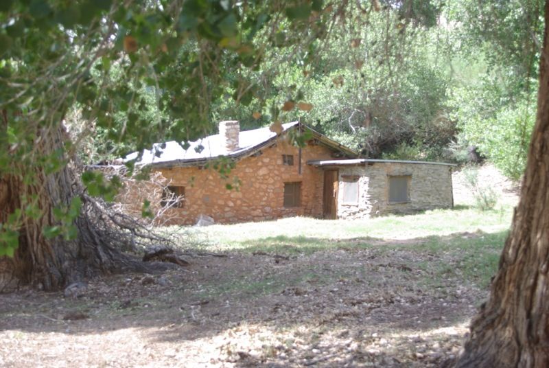
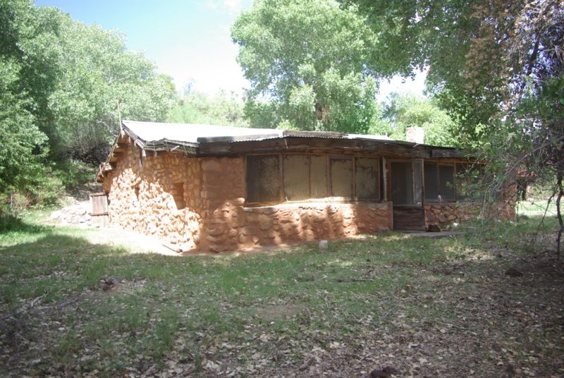
    After lunch in Kanab, we headed east toward Lake Powell. We took a side trip to visit the Paria Movie Set, where a number of western films were shot. All that remains of the movie set are a few foundations. An unexpected side benefit of the trip was viewing the colorful and scenic Paria River canyon that led to the movie set:


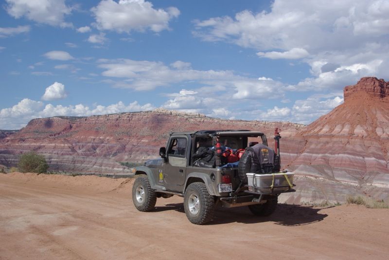
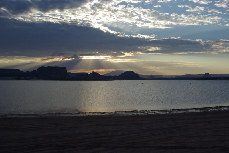
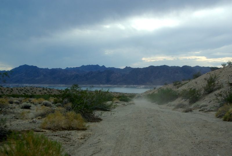
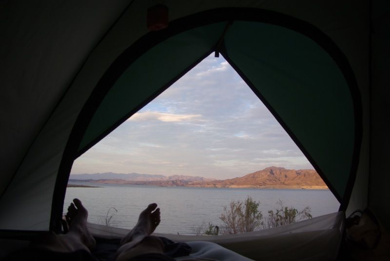
    That night, we set up camp at Lone Rock Beach Campground at Lake Powell. The elevation of Lake Powell was 3,624’ and the temperature was in the high 90s. A swim in the lake provided a welcome relief from the heat. Just before sunset and while I was setting up my tent, we were drenched by a thundershower. After setting up camp, we drove into Page, AZ for dinner and to refuel. The next morning, there were no storms in sight:
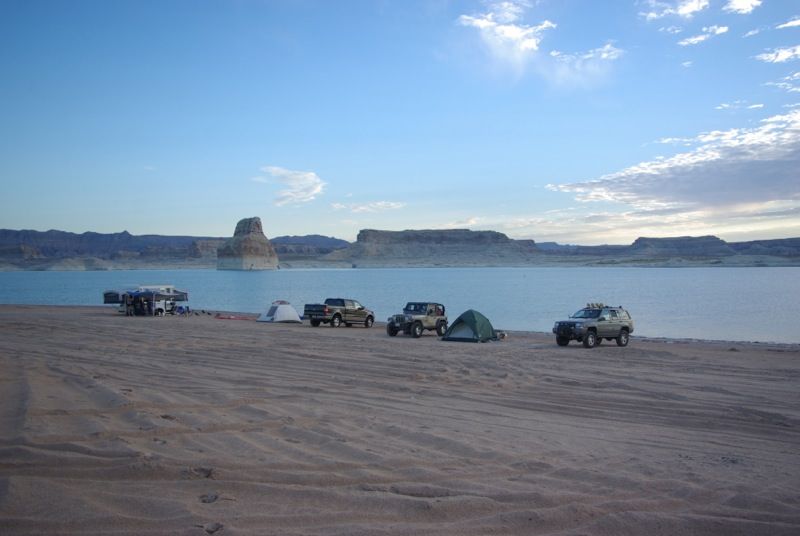
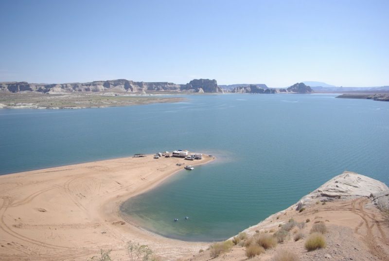
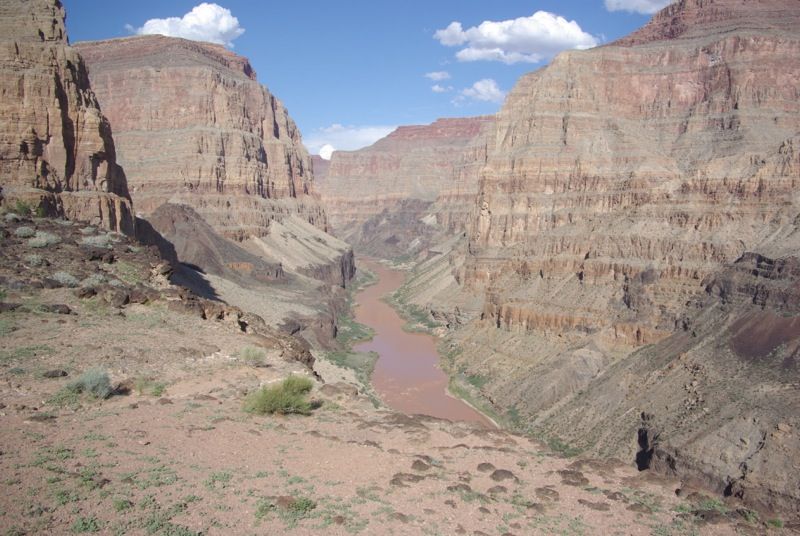
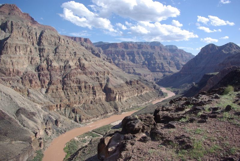
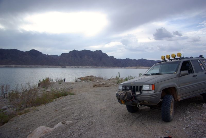


    The first “overlook” of this trip. This is the view of Lake Powell from Lone Rock Beach:


    (continued)
    If you don't like the way I drive, stay out of the bushes!
    KI6MLU

  • #2
    Tuesday, August 28, 2012. The Wave

    We broke camp at Lake Powell and headed to the Wire Pass trailhead on House Rock Valley Road near the Utah-Arizona border. The Wave is a three-mile hike each way with a 500’ elevation gain from the parking area. Because of the terrain, the ranger told us that most hikers take about two hours each way. The temperature was in the 90s, so I loaded my backpack with five quarts of water, some snacks, and a spare battery for my camera. I also brought my GPS with the trail waypoints given to us by the BLM Ranger. I found the GPS to be extremely helpful in finding the site because the trail is unmarked. Shortly after leaving the parking area, we met some tired hikers who were returning and who could not find the site even though they had the detailed map from the BLM.


    Because of the high temperatures, the hike was not pleasant, but it was worth the effort:


    The Ranger told us to look for the desert shrimp that live in the pond at the Wave. Click on this picture for a short video:


    After the hike and the high temperatures, we were exhausted, so instead of setting up camp at Lee’s Ferry, we decided to get rooms at the Marble Canyon Lodge.

    (continued)
    If you don't like the way I drive, stay out of the bushes!
    KI6MLU

    Comment


    • #3
      Wednesday, August 29, 2012. Lee’s Ferry and Marble Canyon

      After leaving Lake Powell, Lee’s Ferry, AZ is the next point on the Colorado River that is accessible by Jeep. Although it is only 7 miles downstream from Glen Canyon Dam, the wilderness areas along the river require a 50-mile detour through Page, AZ or an 80-mile detour around the Vermillion Cliffs National Monument. It is the starting point for rafting trips through the Grand Canyon and the reference point for “river miles” in the Grand Canyon.


      The next overlook of the Colorado River is at Navajo Bridge at river mile 4 (four miles below Lee’s Ferry). Both of us had visited the bridge during a 2009 trip to the area, so we didn’t stop there this time. Here are some pictures of the Navajo Bridge and Marble Canyon as seen from the bridge in 2009:


      Our maps showed many BLM roads that wound through the plateau above the Marble Canyon portion of the Colorado River. Most of the roads were too far from the rim for a good view of Marble Canyon and the river. We found two viewpoints overlooking Marble Canyon. This is at about river mile 10:


      This overlook is at about Mile 28:


      We had identified three other possible overlooks on the map, but we were running low on gas and the usual afternoon thundershowers were beginning to form, so we abandoned our search for overlooks and began the climb from the House Rock Valley to the north rim of the Grand Canyon. The House Rock Valley is at about 5,000’ elevation. We took Forest Road 220, also known as the East Side Game Road to De Motte Campground in the Kaibab National Forest, which is at an elevation of 8800’. The temperature at De Motte was much cooler than in the House Rock Valley, and for the first time in three days, we put on jackets and sweatshirts. We selected a campsite at De Motte, and we were joined by a third Jeep shortly thereafter. We went to the nearby Kaibab Lodge for dinner, and had a nice campfire before retiring for the night.

      (continued)
      If you don't like the way I drive, stay out of the bushes!
      KI6MLU

      Comment


      • #4
        Thursday, August 30 – Grand Canyon North Rim

        On Thursday morning I folded my tent, packed my Jeep and we left De Motte campground. Our intent was to continue visiting as many overlooks between Lake Powell and Lake Mead as we could reach in a Jeep. We headed to the Marble Overlook in the Kaibab National Forest. From there, we were able to contact the fourth member of our group on the ham radio. He was driving from Phoenix to meet us and he was approaching Navajo Bridge, which is about 25 miles northeast of the Marble Overlook. He planned to stop for lunch at Jacob Lake, and then join us as we explored the overlooks. We tried, unsuccessfully, to see him with binoculars. This is what we saw from Marble Overlook. Navajo Bridge is in the distance behind the tree on the left side of this picture:


        The next overlook is at the Saddle Mountain Trailhead, which is in the Kaibab National Forest just north of the Grand Canyon National Park boundary:


        Our next overlook was Point Imperial in Grand Canyon National Park. It is only about two miles south of the Saddle Mountain Trailhead, but in order to reach it by Jeep, we had to return to the highway, air up, enter the park and return to Point Imperial—a distance of about 40 miles. While airing up at the highway, the fourth member of the group caught up to us, so instead of going directly to Point Imperial, we headed to the North Rim Campground so that he could drop his trailer. After checking into the campground, dropping the trailer and unloading some equipment, the four of us drove to Point Imperial.


        The usual afternoon thunderstorms were building as we continued to the next overlook at Port Royal.


        Port Royal is one of the few places on the north rim where you can see the Colorado River. This is the view toward the east and the Colorado River at mile 70:


        The view from Port Royal toward the south:


        The view from Port Royal toward the west:


        We returned to the North Rim Village just after sunset and watched the moon rise before dining at the North Rim Saloon:


        After dinner, we relaxed around a campfire before retiring for the night.

        (continued)
        If you don't like the way I drive, stay out of the bushes!
        KI6MLU

        Comment


        • #5
          Friday, August 31, 2012

          On Friday, we continued our quest to visit every overlook we could reach by Jeep, but I knew from past visits that we could not visit all of the overlooks in this part of the canyon in the time we had remaining at the north rim of Grand Canyon National Park. Because of the Labor Day holiday, we could not get campground reservations for the weekend, so this was our last day in this part of the Grand Canyon.

          Our first objective was to visit the overlook at Point Sublime. Although permits are required to camp at Point Sublime, no permits are necessary for a brief daytime visit to the point. This is Crystal Creek Canyon enroute to Point Sublime. Point Sublime is at the end of the ridgeline on the right of this picture:


          This is the view of the Colorado River and the Grand Canyon from Point Sublime. The view of the river is at approximately mile 100:


          We left Point Sublime and entered the Kaibab National Forest. This 20-mile stretch of the North Rim has ten overlooks that can be reached by Jeep. Unfortunately, due to the drainage patterns and wilderness areas, the roads do not run along the rim; they run perpendicular to the rim, so travel between two adjacent overlooks which might be only a mile apart may require a 20 mile road trip. In our 2009 North Rim trip, we spent three days visiting those overlooks. Because of the limited time remaining in the area, we chose to visit Fire Point and Jumpup Point. We arrived at Fire Point just as a thunderstorm struck the area:


          We finished lunch, but the storm did not abate, so we continued to Jumpup Point. About ten miles from Jumpup Point, I had a mechanical problem with my Jeep; I lost the track bar bolt that attaches the track bar to the frame. I did not have an exact replacement for the missing bolt, but I was able to make a temporary trail repair with a slightly smaller diameter bolt. I decided to head to Kanab, UT which was about an hour away to obtain the proper bolt, while the rest of the group continued to Jumpup Point.

          [sized]http://i180.photobucket.com/albums/x277/ZJWOODY/261.jpg[/sized]

          I arrived in Kanab safely and obtained the proper bolt. Meanwhile, the rest of the group encountered another thunderstorm and decided to return to the campground instead of continuing to Jumpup Point. That evening, we ate dinner at the North Rim Lodge and relaxed around the campfire.

          [sized]http://i180.photobucket.com/albums/x277/ZJWOODY/265.jpg[/sized]

          (continued)
          If you don't like the way I drive, stay out of the bushes!
          KI6MLU

          Comment


          • #6
            Saturday, September 1, 2012 – Kanab Point and SB Point

            On Saturday morning, we checked out of the North Rim Campground and said farewell to one of the group. The remaining three of us were continuing on to explore the western portion of the Arizona Strip while the other member of the group had reservations at the Kaibab Lodge and Marble Canyon Lodge for the Labor Day weekend before returning to Phoenix.

            After stopping at the Jacob Lake Inn to stock up on cookies, we drove to Fredonia, AZ and filled our gas tanks and gas cans. Then we aired down our tires because we would be on dirt roads for the next 500 miles. Our first overlook was at Kanab Point. We reached the overlook in mid-afternoon. The first thirty miles was on a smooth, wide, BLM graded dirt road, but the last ten miles was on a narrow two-track trail that wound through the thick brush. This is a view toward the east from Kanab Point. Jumpup Point is on the left, Kanab Creek flows from the left into the Colorado River:


            This is the Colorado River at about mile 145 as seen from Kanab Point:


            The next overlook was SB Point. The road shown on our GPS did not exist, and the alternate road was little used and overgrown. It took us nearly three hours to travel 20 miles from Kanab Point to SB Point.


            There was about an hour of daylight left when we departed SB Point, and well after dark when we arrived at the campground at Toroweap Point. The campground at Toroweap does not take reservations, and since it was the Labor Day weekend, we were worried that we might not find a campsite. Fortunately, there were campsites available when we arrived. We set up our camp, and probably annoyed the campers in the adjoining site because we stayed up and talked for awhile before going to bed.

            Sunday, September 2, 2012 – Toroweap Point, Whitmore Overlook and Bar 10 Ranch

            We arose on Sunday morning, loaded the Jeeps and drove the short distance from the campground to the Toroweap Overlook. I tried, but I could not get either of my friends to pose for a picture at the edge of the overlook. Toroweap Point is at river mile 177 and the vertical drop to the river is about 3,000 feet:


            We left Toroweap and took a very rough shortcut on a rocky 4WD corridor through the Mount Logan Wilderness. We saw some very tame deer while traversing the corridor, but the road was so rough that we probably would have saved time if we had stayed on the main road and went around the wilderness area.


            We arrived at the Bar-10 Ranch in time to have lunch. The Bar-10 Ranch is a working cattle ranch, but it also serves as the transfer point for rafters going to and from the river. It takes the rafts about six or seven days to travel 177 miles to Whitmore Canyon from the starting point at Lee’s Ferry and it takes about three more days to travel the remaining 100 miles to Lake Mead. Helicopters pick up the rafters at Whitmore Canyon and take them to the Bar-10 Ranch where airplanes take them to Las Vegas or back to Lee’s Ferry. The helicopters also bring other rafters who get aboard for the trip downriver to Lake Mead. About 13,000 people pass through the Bar-10 Ranch each year. The Ranch provides lodging, meals and activities such as horseback riding and ATV tours of the area. We had made prior arrangements to purchase dinner, a shower, and gasoline from the ranch.


            After lunch, we explored the area and searched for a campsite for the night. We visited the cabin at Paw’s Pocket, about five miles south of the ranch:


            Then we headed to the Whitmore Canyon Overlook at river mile 177. The overlook is only 800’ above the river and the temperature was in the high 90s when we arrived. There is a trail that leads from the overlook to the river, and we were tempted to hike down to the river to go for a cool dip, but it was getting late in the afternoon, and we did not want to miss dinner at the Bar-10 Ranch.


            The Whitmore Overlook was too far from the Bar-10 Ranch to set up our camp, so we decided to set up camp in the Grand Canyon Parashant National Mounument immediately south of the Bar-10 Ranch, then headed to the Ranch for a shower and dinner. After dinner, the staff presented a Western show on the lawn area in front of the lodge. After the show, we returned to our campsite for the night.

            [sized]http://i180.photobucket.com/albums/x277/ZJWOODY/340.jpg[/sized]

            (continued)
            If you don't like the way I drive, stay out of the bushes!
            KI6MLU

            Comment


            • #7
              Monday, September 3, 2012 – Kelly Point

              Monday was Labor Day but the holiday did not change the routine of the Bar-10 Ranch. Planes and helicopters began arriving at the Bar-10 airstrip and heliports around 8:00 am. Click on the picture for a video:


              We needed to top off our fuel tanks and refill our gas cans, but the ranch manager asked us to wait until mid-morning so they could take care of their arriving and departing guests. After the airplanes departed and the helicopters completed their shuttles, we refueled and headed to the next overlook, which was at Kelly Point. Enroute to Kelly Point, we stopped to visit the historic Mt. Trumbull Schoolhouse.


              After visiting the Mt. Trumbull Schoolhouse, we continued to Kelly Point. The roads on BLM administered land were wide, smooth graded dirt roads and we were able to maintain a good rate of speed. The last 24 miles to Kelly Point were on National Park Service administered land. That road was very rough and rocky. It took us three hours to travel the last 24 miles to Kelly Point, where we camped for the night.


              At Kelly Point, campfires were not allowed due to seasonal fire restrictions, so we gazed at the stars until we went to bed.

              Tuesday, September 4, 2012 – Twin Point

              On Tuesday, we broke camp and headed back across the rough, rocky road and then continued on relatively smooth roads to Twin Point, where we ate lunch and enjoyed the view:


              Our plan was to cross the Grand Wash Cliffs via Hidden Valley Road, then complete our journey to Lake Mead at Grand Wash Bay. However, we were low on fuel and it was getting late, so we changed course and drove to Mesquite, NV via Limekiln Pass, where we got a hotel room for the night.

              Wednesday, September 5, 2012 – Tassi Ranch and Lake Mead

              On Wednesday morning, we checked out of the hotel in Mesquite, NV. The temperature was forecast to reach 100 degrees. We topped off our gas tanks and headed back toward Lake Mead. Our route took us over Whitney Pass and we stopped to visit this pioneer gravesite. While we were there, the owner of a nearby ranch drove by and she told us that her parents are buried there.


              We continued to the ranchhouse at Tassi Ranch. The buildings were constructed in the 1930s around a spring. Ponds and irrigation ditches were built to support cattle ranching. The property has been vacant since the 1980s and signs outside the buildings warn of the possibility of hanta virus infestation.


              We continued past Tassi Ranch to Grand Wash Bay. We looked forward to a cool dip in the waters of Lake Mead, but due to the low water level in Lake Mead, we found that thick reeds surrounded that arm of the lake and we could not easily reach the water. Plan B was to drive to the Overton arm of Lake Mead. Thunderclouds built up as we approached the lake, and severe flash flood warnings were issued for the area just to the south of Lake Mead. Fortunately, the storm missed our part of the lake.


              We enjoyed a very pleasant swim in Lake Mead. The water was warm as bath water. We decided to stay and camp on the beach. I enjoyed a late night swim before retiring for the night. The next morning, I awoke to this view from my tent. When Lake Mead is full, this spot is under about 100 feet of water:


              After a nice swim, I packed up my camping gear for the last time and we reluctantly left Lake Mead for home. Upon reaching pavement, we aired up for the first time in five days, ate lunch in Glendale, NV, then we split up and headed home, one to Nevada, one to Arizona, and I headed back to Southern California.


              (end of report)
              Last edited by Russ Chung; 09-11-12, 01:02 PM.
              If you don't like the way I drive, stay out of the bushes!
              KI6MLU

              Comment


              • #8
                Wow.... amazing!!! I"ve never seen anything like the Wave. Those are my favorite pics!
                :gun:'99 TJ Sport:gun:

                Comment


                • #9
                  That's one thing I never think to bring, extra nuts and bolts of any size!

                  Great photos, looks like it was a very fun trip :-)
                  [COLOR="#FF0000"]R[/COLOR]edneck [COLOR="#FF0000"]D[/COLOR]riveway [COLOR="#FF0000"]F[/COLOR]ab
                  www.DanielBuck.net - www.DNSFAIL.com - www.FurnitureByBuck.com

                  Comment


                  • #10
                    Very very cool Russ. I have never been to the North Rim and it just moved way up my bucket list. Thanks for the detailed report and fantastic pictures.
                    Over 2500 hours donated to the San Bernardino National Forest. Life member of CA4WD, CORVA & BRC. Tread Lightly Trainer. Reforestation Supervisor. CASSP

                    Comment


                    • #11
                      Nice report Russ. I have done an extended trip through the Toroweep area and it was as beautiful as I remember.
                      Looks like the Wave has just appeared on my list-o-things to see.

                      Comment


                      • #12
                        That looks like an amazing trip. Thats awesome to cover that distance and with the majority of it on dirt too! Glad you were able to get a new bolt and continue your adventure.

                        Chris

                        Comment


                        • #13
                          Very nice trip and trip report. We have been camping/boating at Lone Rock Beach pretty much every year since 1976, usually for two weeks. Looks like we left a week before you got there. I did a motorcycle trip from Mesquite to Bar 10 a couple of years ago the beginning of May. That is a nice place and wonderful people and food. We stayed two nights and explored the area.

                          I have always wanted to visit The Wave, but have never quite been able to schedule. Your pictures were inspiring.

                          Thanks again.
                          Rich

                          Comment


                          • #14
                            Great report, Russ!!
                            IN A LAND OF FREEDOM WE ARE HELD HOSTAGE BY THE TYRANNY OF POLITICAL CORRECTNESS!!

                            Better To Burn Out Than To Rust Out!

                            Comment


                            • #15
                              Nice report Russ, I've considered exploring this area for quite awhile. Thanks for taking us along. Great photography.

                              Comment

                              Working...
                              X