 Tweet
Tweet
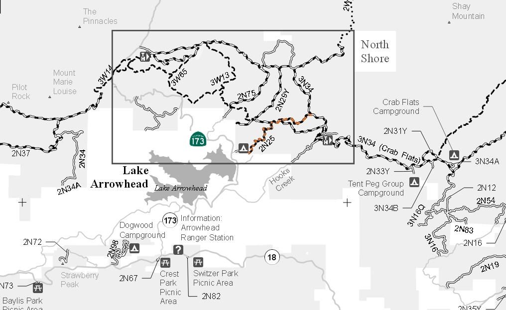
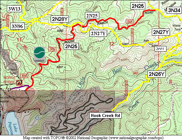
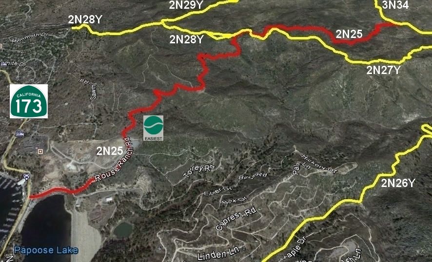
2N25 Rouse Ranch Road
Length: 3 miles
Maintenance Level 3: Maintained for travel by prudent drivers in a standard passenger car. User comfort and convenience are low priorities.
2N25 is a multi-use road open to street legal vehicles, green sticker vehicles, mechanized vehicles (bicycles), equestrian travel and foot travel. Motorized vehicles yield to all other users.
4x4 Vehicle Trail Rating: Green Circle Easiest
Elevation: 4900’ to 5300’
Torrey Road & Rouse Ranch Road 11S 484601E 3791287N
West entrance on Rouse Ranch Road at 11S 485069E 3791719N
Middle entrance on 2N28Y at 11S 485936E 3792812N
Middle entrance on 2N27Y at 11S 485931E 3792795N
East entrance on 3N34 at 11S 487252E 3793059N
UTM coordinates acquired using Google Earth (WGS84 datum)
It is always a good idea to call the ranger station before heading in to the forest and get a current conditions report. Arrowhead Ranger Station (909) 382-2782
SBNF Motor Vehicle Use Map (MVUM)
SBNF Google Earth file