 Tweet
Tweet
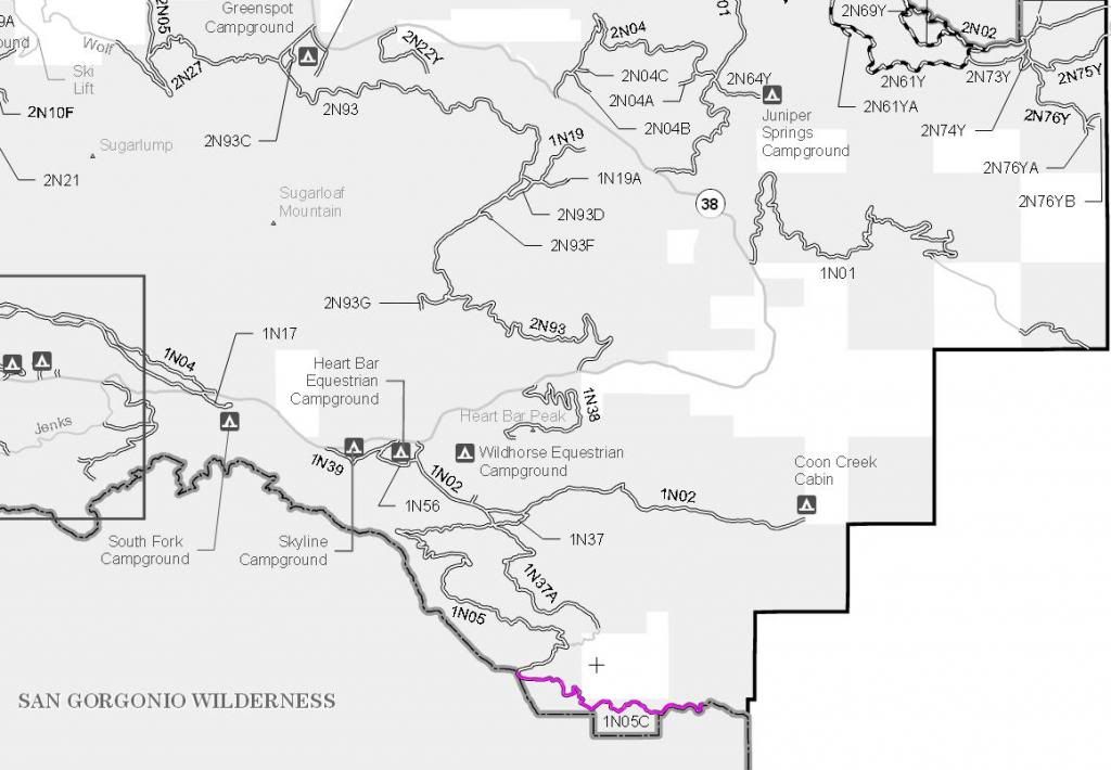
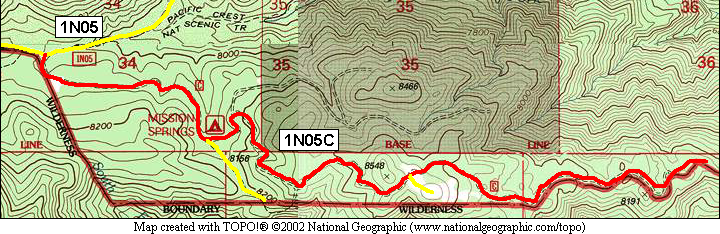
1N05C Cabezon Rim
The SBNF Google Maps call this trail 1N05C Airplane Flat
Length: 3 miles
Maintenance Level 3: Maintained for travel by prudent drivers in a standard passenger car. User comfort and convenience are low priorities.
1N05C is a multi-use road open to street legal vehicles, mechanized vehicles (bicycles), equestrian travel and foot travel. Motorized vehicles yield to all other users.
Trail Rating: Green Circle Easiest
[color=red]1N05C is closed for the winter to wheeled vehicles. 1N05C is open during the winter to tracked vehicles if the snow on the ground is over 12" deep.[/color]
Elevation: 8000’ to 8500’
Trail adopted by: Southland Sno-Riders
Entrance on 1N05 at 11S 521635E 3775990N
UTM coordinates acquired using Google Earth (WGS84 datum)
It is always a good idea to call the ranger station before heading in to the forest and get a current conditions report. Big Bear Ranger Station & Discovery Center (909) 382-2790 Mill Creek Ranger Station (909) 382-2882
SBNF Motor Vehicle Use Map (MVUM)
SBNF Google Earth file