 Tweet
Tweet
3N17 - White Mountain trail traverses the mountain range from east to west with lots of challenging hills along the way. Stop by the Wright Mine for lunch then climb Half Mile hill. The fire burned up 3N11 through Wright Mine so this trail may be closed for restoration.
-
-
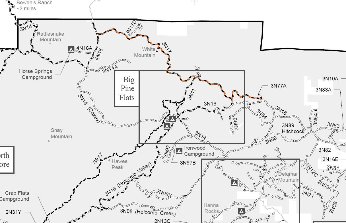
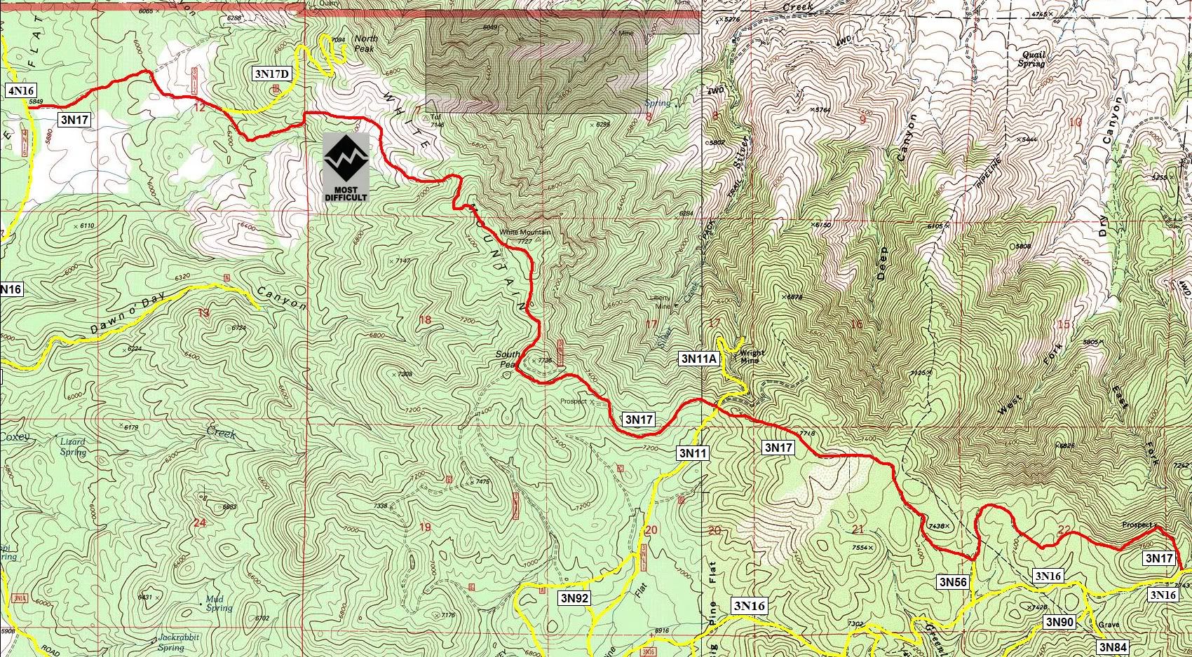
3N17 White Mountain
Length: 8 miles
Trail Rating: Black Diamond Most Difficult - Street legal vehicles and green sticker vehicles allowed
Elevation: 5850' - 7600'
Trail adopted by: Orange County 4 Play
East entrance on 4N16 at N34� 21.611 W117� 03.442
2N17 Spur exit at N34� 21.599 W117� 02.444
Middle entrance on 3N11 at N34� 20.367 W116� 59.984
Middle entrance on 3N56 at N34� 19.716 W116� 58.684
West entrance on 3N16 at N34� 19.669 W116� 57.635
Lat/Lon format is hddd� mm.mmm WGS84 datum
It is always a good idea to call the ranger station before heading in to the forest and get a current conditions report. Big Bear Ranger Station & Discovery Center (909) 382-2790
SBNF Motor Vehicle Use Map (MVUM)
SBNF Google Earth fileOver 2500 hours donated to the San Bernardino National Forest. Life member of CA4WD, CORVA & BRC. Tread Lightly Trainer. Reforestation Supervisor. CASSP
Comment